Geodata International 5.04
Geodata International - World-wide towns, municipalities and postal codes
Geodata International - World-wide database of countries with georeferenced towns, municipalities, postal codes and administrative units with WGS84 and UTM coordinates and elevations for geocoding, proximity search, navigation, distance calculation.
Software Specs
Publisher:............ C. Killet Software Ing.-GbR
License:............... Data Only
Price:................... $190.00
File size:.............. 791 KB
Downloads:.........
Release date:...... 02 Oct 2013
Last update:........ 06 Nov 2013
Language:............ German, English, French, Italian, Dutch, Portuguese, Spanish
Publisher review for Geodata International 5.04:
Review by: C. Killet Software Ing.-GbR
Geodata International - World-wide database of countries with georeferenced towns, municipalities, postal codes and administrative units with WGS84 and UTM coordinates and elevations for geocoding, proximity search, navigation, distance calculation. There are database tables from more than 160 countries. Often is it necessarily, for an address characteristic, e.g. the place name or the postal code, to establish a local relationship - a georeference. The georeference can be used e.g. to show a customer the nearest chain store by doing a proximity search. On the basis of the georeferences business zones, statistics or general maps can be made. Towns, municipalities and postal codes can be assigned to the superordinated administrative units. Distances between places or postal areas can be determined with the coordinates contained in the database tables. For that the georeferences are available in all country database tables as UTM coordinates on the natural and an uniformly meridian strip and as geographical coordinates in degree and deg/min/sec notation. With the elevation data from a Digital Elevation Model the ground level height of each place can be determined. The database tables are present in the file format CSV (Comma Separated Values). The character set used is UTF8. This format is used often and in most cases you can import data directly into your own data system. The freeware program CONVERT, downloadable from the KilletSoft site, converts the available database tables to other data formats and character sets with the necessary sortings and selections. With the program, for example, CSV data can be converted to the SDF format (Simple Document Format) or to the dBase format. For the use of the data on different platforms it is possible to select between the character sets ASCII, ANSI, UTF8 and UniCode. Thus the import of the data in any database management system or file system will be possible.
Requirements:
All systems
Operating system:
Java,Linux,Mac Other,MS-DOS,Unix,Win2000,Win7 x32,Win7 x64,Win98,WinMobile,WinOther,WinServer,WinVista,WinVista x64,WinXP,Other
Release notes:
Major Update
Whats new in version 5.04:
Database of Austria updated to actual date September 2013. Database Germany and Italy updated to actual date January 2013. Databases of 13 countries added. 129 Countries updated on actual date April 2012. Databases sorted by country specific character sets.

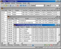
Geodata International screenshots:
Geodata International download tags:
geo data geodata point pointdata spatial reference coding coordinates places local localities town quarters postal zip code periphery search distance calculation elevation list listing municipality database longitude latitude g
Copyright information:
Based on 0 ratings. 0 user reviews.
DBDesigner 4
DB-MAIN
SQL-Front
Full Convert Enterprise
PC-Telephone
Liquid Desktop
Advanced Access Repair
Oraspeed SQL Editor
ERD Concepts
Accounting and Finance
Office Suites and Tools
Inventory and Barcoding
PIMS and Calendars
Databases and Tools
Project Management
Helpdesk and Remote PC
Calculators and Converters
Vertical Market Apps
Investment Tools
Math and Scientific Tools
Other
Timesheets MTS Software
Softvoile
NewFreeDownloads
Office Suites
PIMS
Math
Calculators
Helpdesk
Databases
Accounting
Inventory